Admin
Sep-17 , 2023

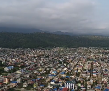
Feed in collaboration with Hetuada Sub-Metropolitan City, Nepal Flying Labs, and Engineering Association Nepal, Bagmati conducted a drone mapping survey in Hetuada, Makwanpur district during this lockdown. The Institute of Himalayan Risk Reduction aims to assess and understand the risk to contribute to sustainability.
FEED has published its voluntary commitment to the Sendai Framework. This commitment aims to use drones, geospatial, and other frontier technologies for enhancing disaster risk assessments and development planning, thus contributing to sustainability. To reach the goal of this commitment, FEED is conducting an Aerial Survey using Unmanned Aerial Vehicles (UAVs) in one of the rapidly urbanizing cities of Nepal, Hetauda Sub-Metropolitan City in the capital of Bagmati Province - Nepal. This survey aims to capture high-resolution images of the city and develop the Digital Elevation Model (DEM) to carry out a number of risk assessments of the city. This will involve local volunteers and engage them with the application of Science, Engineering, Technology, and Innovation (SETI) initiatives to implement the Sendai Framework.
The technical team first laid out accurate Ground Control Points (GCPs) all over the Metropolitan city and started collecting aerial imageries. DJI Phantom 4 Pro drone was used for the overall data collection purpose. We have installed about 45 GCPs at different locations in Hetuada city. The team flew drones for 26 days over a 120 km² area capturing 16244 Images using a single Phantom.
Nepal has low-resolution satellite imagery, it is rarely of sufficient quality to support responders in critical decision-making after disasters and to Plan a city. This project intends to provide the blueprints for developing sustainable and well-planned cities along with Disaster Risk Reduction. Aerial images taken by drones greatly accelerate and simplify topographic surveys for land management and planning. This holds true for the construction of roads, buildings, and Public utilities. Data collection by drones is easily repeatable at low cost, images can be taken at regular intervals and overlaid on the original blueprints to assess whether the construction work is moving according to plan specifications.
Hetauda Sub-metropolitan had prioritized the use of frontier technology, like drones, to generate high-resolution maps. The obtained maps will also help in drafting the urban planning, resource, and capacity mapping, house numbering system, updating the base map of Hetauda Sub-Metropolitan, and so on. This data can also help to predict landslides and prevent potential damage to roads, construction, and bridges.
Nepal is lagging far behind the technology and innovation. These is our small steps towards creating smart cities and communities alongside with Nepal Government. Thousands of people directly or indirectly benefit from this project.
Recent Post
Similar post that you may be intrested in
FEED FOR BETTER FUTURE
Request More Information
Forum for Energy and Environment Development (FEED) P. Ltd.
Jhamsikhel Marg, Lalitpur, Nepal
© 2023 Forum for Energy and Environment Development (FEED) P. Ltd.
